
There is a stone tower atop the hill behind the Villa Marina gardens, tucked away and accessible by a small path. It is squat and round and built of thin courses of Manx slate, with an arched doorway now closed off by a plain iron gate. The castellated top has given up and grown a small garden of its own. Fuchsia has taken the ground around it. On a bright afternoon it looks like exactly what you would expect to find in a municipal pleasure garden, which is to say a piece of Edwardian scenery built to look old.
It is nothing of the sort, and the giveaway is cut into the stone at the bottom.
Culture Vannin describes it as the old marker tower, built as an aid to shipping. A record on iMuseum goes further and refers to an article claiming it served as a lighthouse guiding ships into the harbour before the light was put up on Douglas Head, which would place it before 1832. I would want to see the full article before repeating the lighthouse part as settled, and I have not managed to find it yet. But a marker is an easier claim, and it fits the shape of the thing. It has no lantern and never looks as though it had one. It is a tower to be seen from the sea rather than a tower to shine from.
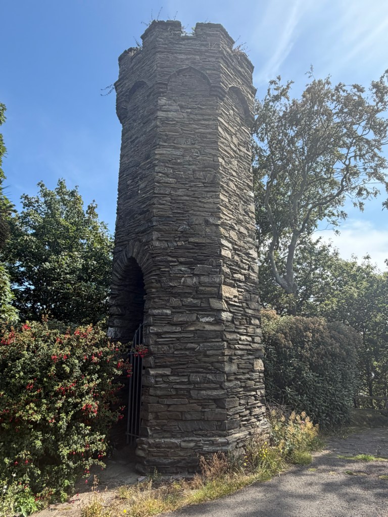
What makes all of this plausible is where it stands, and what used to stand between it and the sea. The gardens sit on what was the estate of Marina Lodge, a Regency house with enclosed grounds which at one point housed the Lieutenant Governor and later belonged to Henry Bloom Noble. The land was acquired in 1806 by the architect George Steuart, passed through his son and then through Pigot, and on Pigot’s death in 1868 Noble bought it for seven thousand pounds. The house came down and the Villa Marina opened in 1913.
The hill matters too. A marker does not want to be down at the water. It wants height, and a little distance back from the shore, so that it can be picked up from well out in the bay and stay in view as a vessel comes in. Set where it is, it would have stood clear against the sky.
Now take away everything that has since been put in front of it. Harris Promenade was not built until 1868. The sea wall for the Loch Promenade was not begun until 1874, and that promenade opened on reclaimed land in 1878. Before all of that the houses on Sand Street backed straight onto the beach and flooded when the bay felt like it. The tower had open estate falling away below it and then the water, with no promenade, no terraces of tall boarding houses, and no Villa Marina in the way. What is now a tower tucked behind a concert hall was once a tower standing over an empty slope with a clear view of the whole bay.
Which brings me to the part I actually went there for.
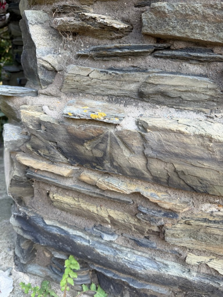
There, on the corner of the base, is an Ordnance Survey bench mark. A broad arrow, and a very fine one. It is larger and more deeply cut than most of the ones I found around the town the other day, the mason having had the luxury of a good flat face of slate to work into. As I have now seen several times, there is no horizontal line above the apex. A projecting course of stone sits directly over it and does the job of the line.
The survey mark was made in 1866. So whatever the tower was for, and whoever put it there, it was standing and worth levelling from before there was a promenade below it, and long before anybody thought of building a concert hall in the garden.
I stood in the fuchsia for rather longer than a grown man ought to, looking at a scratch in a wall, and I was extremely pleased.

