Stamps
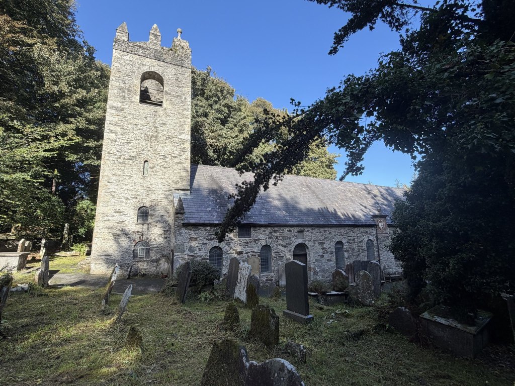
On Saturday we went to Kirk Braddan for the Isle of Man Philatelic Federation’s stamp and postcard fair. I signed up as a member and bought a book on local stamps and postcards, which I have not read yet but which seems to be more of a history book. That was at the new church, which is new only by comparison: it was finished in 1876, to a design by J. L. Pearson, the architect who went on to build Truro Cathedral. The church it replaced was not pulled down. It was left where it stood, virtually next door, and my girlfriend said there was an Ordnance Survey mark on it, so we popped over. We were following an old map.
I had never been before, and it was amazing.
As it turns out, the old church has been on a stamp itself. The Isle of Man Post Office put it on the 35p value of the Christmas issue in 2010.
The mark
First things first. The mark is on the church itself, at a corner, slightly tucked behind a drainpipe, and it is a nice deep one.
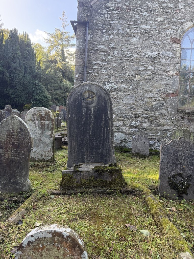
Like the one we found on Christian Street in Peel in August, this one has its own line: a level bar cut straight into the face of the stone, with the arrow underneath pointing up at it. The bar is deep enough to throw a shadow. The arrow has fared less well, and reading it is now mostly a matter of telling the cut from the lichen. One account of the rebuilding of the church says its corners were done in Foxdale granite, which would explain why the bar has kept its edges.
The old map has it too, hard against the east end of the church: B.M. 74.2, which is 74.2 feet above the survey datum. The sheet was surveyed in 1866, when this was still the parish church. By the time it was published, in 1879, the parish had moved next door, and the mark stayed behind with the building.
Two from Douglas
It was the third church mark of the week. Earlier in the week I had snapped two at St Mary’s in Douglas, and I have not had a chance to weave them in anywhere, so here they are. They are only a few metres apart, and neither is on any old map that I could see.
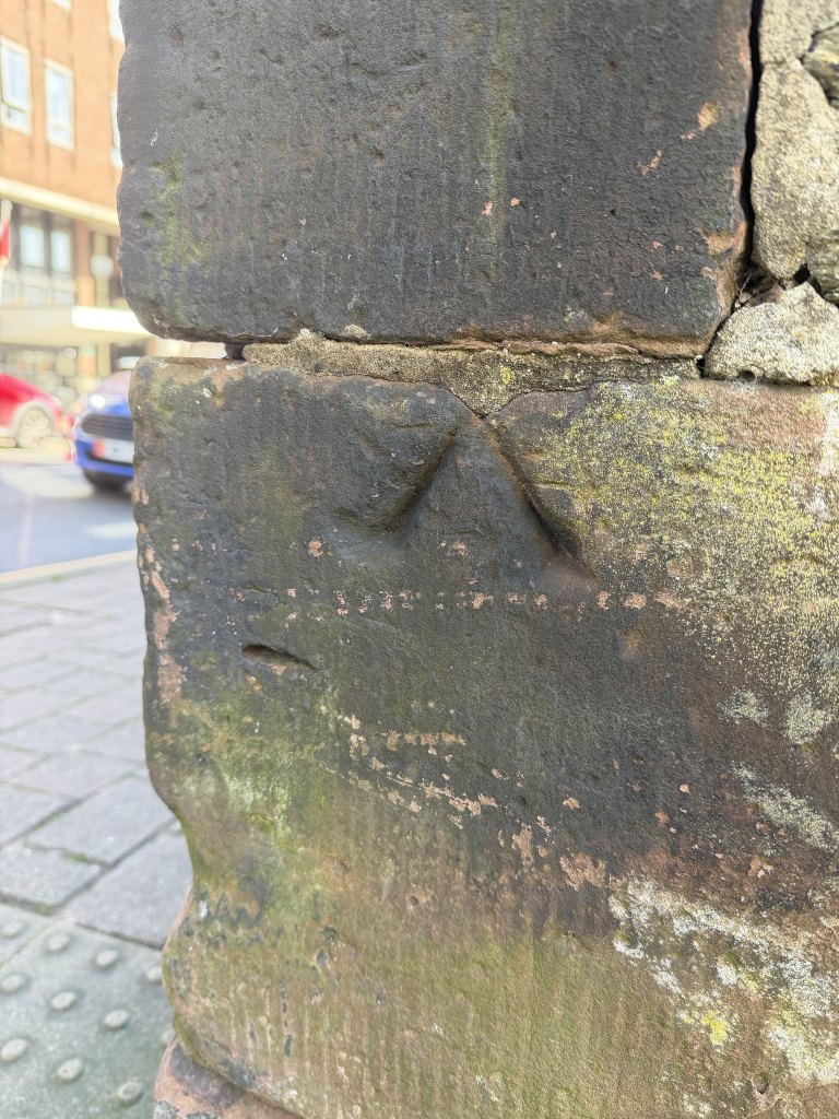
The first is an arrow and nothing else, cut deep into a corner block at the pavement. It has no line of its own. Its point runs up to the top edge of the block and borrows the joint.
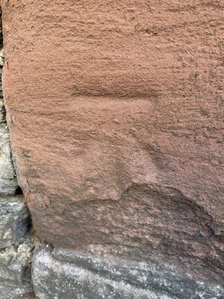
The second has a line and not much else. It is in red sandstone, which is soft, and the arrow beneath the line has nearly gone.
St Mary of the Isle had its foundation stone laid in 1857 and was finished in 1859, so it was standing when the Island was surveyed, which makes the absence of both marks from the maps a small puzzle.
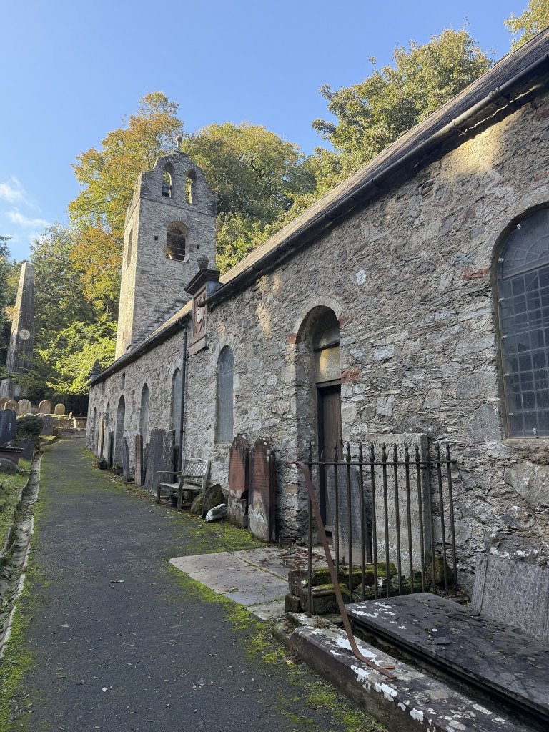
The old church
The site is a great deal older than the building. Bishop Mark held a synod here in 1291. What stands now is largely a rebuilding of the 1770s, with a tower dated 1773, and the Victorians, who got at almost everything, never got at this. We did not go inside. Had we done so we would have found box pews, a gallery and a three-decker pulpit, and the carved crosses of the parish, Celtic and Norse, which on the old map are still out in the churchyard, marked Cross Stones. One of them carries a runic inscription recording that a man called Hross-Ketill betrayed his sworn friend under truce. A thousand years on, the stone is still telling people.
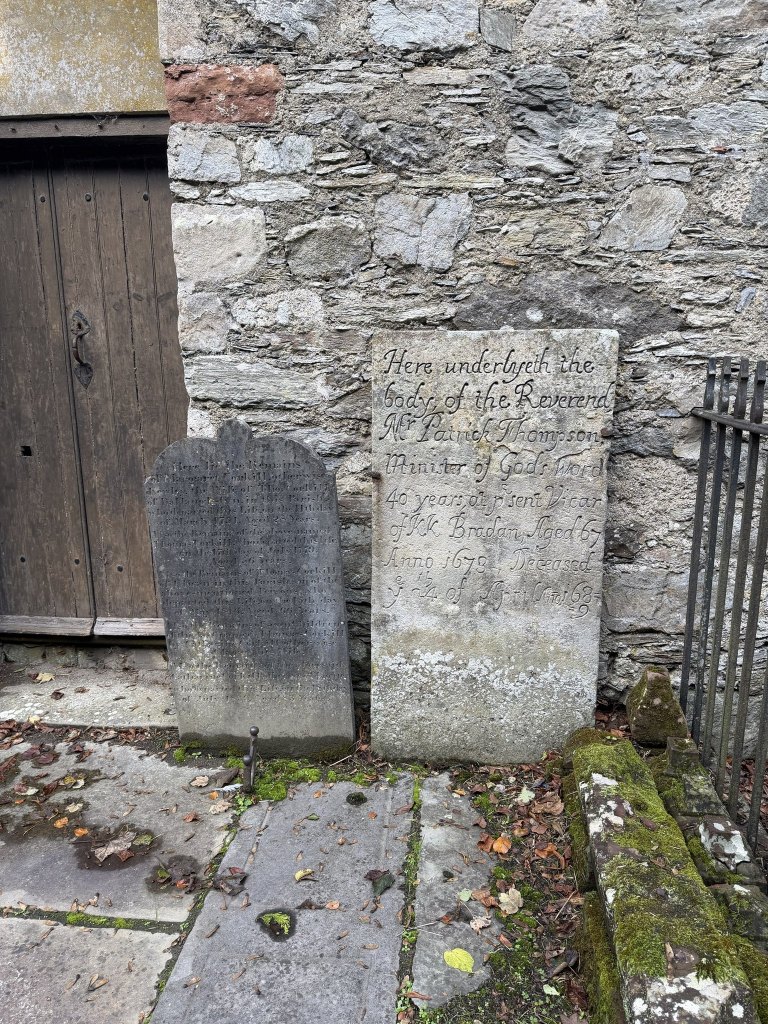
Against the wall by the south door stands the stone of the Reverend Patrick Thompson. It opens Here underlyeth the body, which was not true when the words were cut. The inscription describes him as minister of God’s word for forty years and at present vicar of Kirk Braddan, aged 67: he had it carved while he was alive, which is one way of making sure it is right. The date of his death was added afterwards in a smaller, tighter hand, and the final 9 of 1689 did not fit on the line and had to go underneath. The parish register for that year records three deaths in the family within two months, the son first, then the mother, and last of all the father.
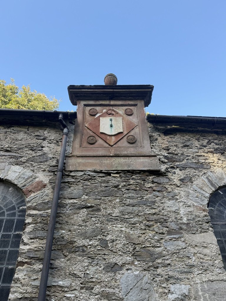
Higher up the same wall is a sundial, surmounted by the triskellion.
The obelisk
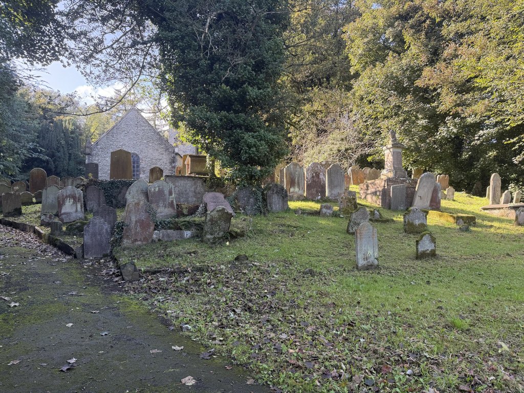
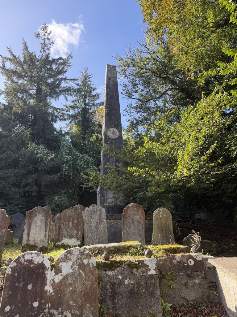
The churchyard is full of ancient graves, the stones leaning into one another under the trees, and standing over them is a large obelisk.
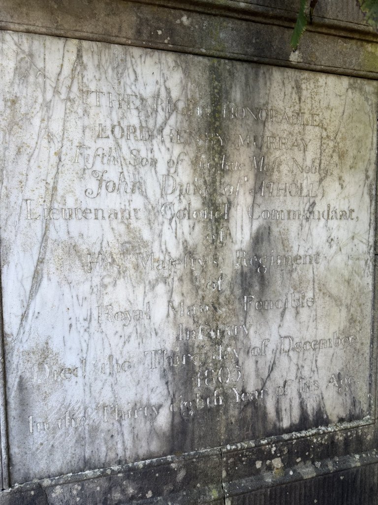
The marble panel names Lord Henry Murray, fifth son of John, Duke of Atholl, and Lieutenant Colonel Commandant of the Royal Manx Fencible Infantry, who died on the third day of December 1805 in the thirty eighth year of his age. The Atholls followed the Stanleys as Lords of Mann. The Lordship passed to them in 1736, and Lord Henry’s parents sold its sovereign rights to the Crown in 1765, a couple of years before he was born. His elder brother, the fourth Duke, became Governor in 1793 and raised the Fencibles, a regiment for home defence, which Lord Henry commanded and took to Ireland in 1798.
A second panel says who paid for it: the officers of the regiment, for their Commander and their Friend. Underneath they put a line of Virgil, from the sixth book of the Aeneid, where Anchises in the underworld mourns the young Marcellus: let me at least heap up these gifts, and perform an unavailing duty.
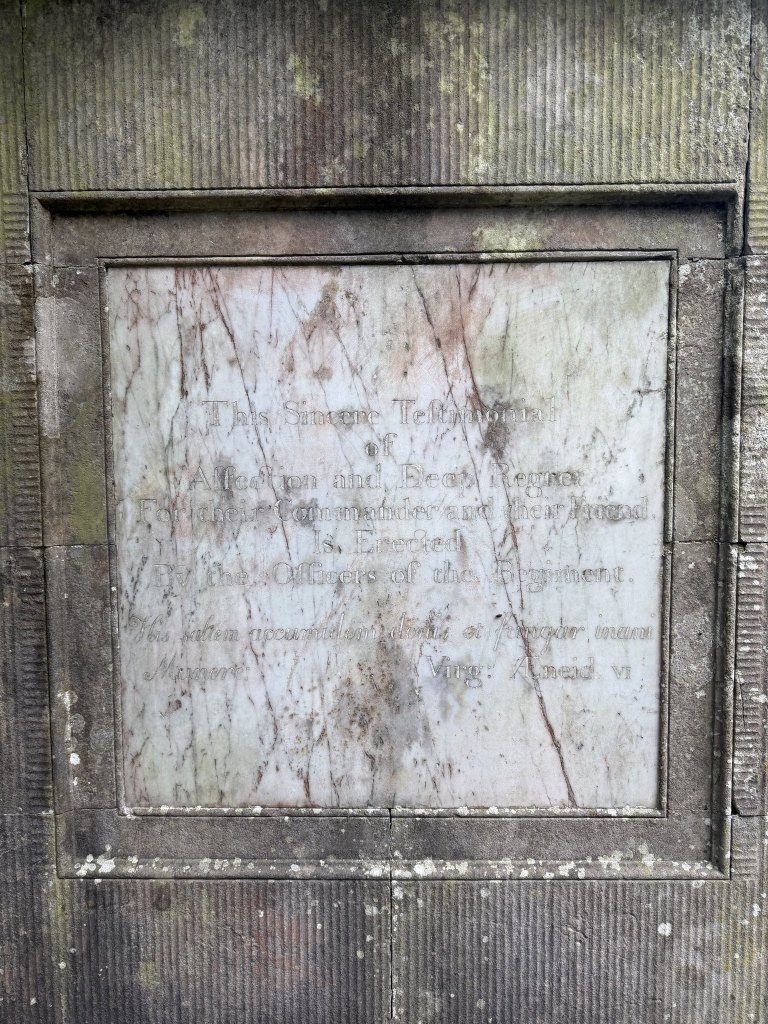
The obelisk was designed by George Steuart, the Atholls’ architect, who also gave Douglas the Red Pier and Castle Mona. He died in Douglas in December 1806, a year after Lord Henry, and was buried at Braddan as well.
The plaques
Some of the graves have small plaques beside them, and they were fascinating.
One is for Samuel Ally. The stone itself calls him an African and native of St Helena, who died on 28 May 1822 aged 18. “Born a slave,” it goes on, “and exposed in early life to the corrupt influence of that unhappy state, he became a model of truth and probity for the more fortunate of any country or condition.” The last lines say that it was put up by a grateful master to the memory of a faithful servant, who repaid the boon of Liberty with unbounded attachment.
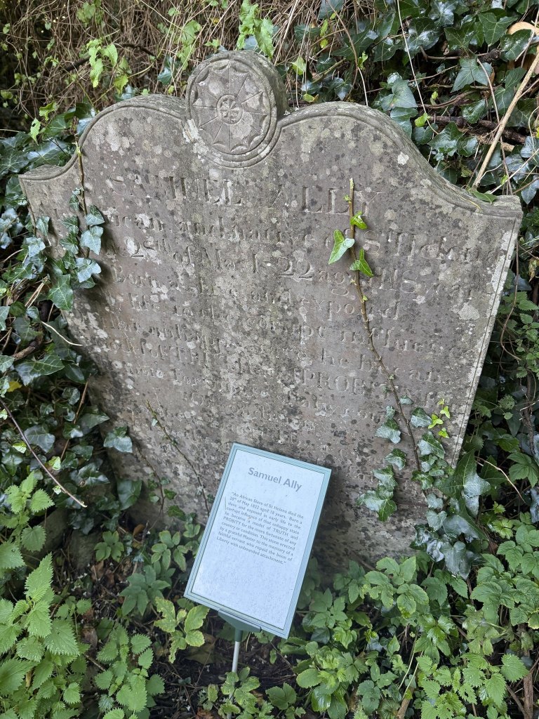
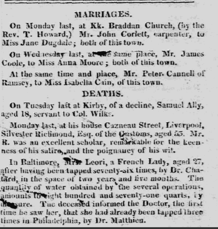
The master was Colonel Mark Wilks, a Manxman who was Governor of St Helena when Napoleon was delivered there, and who freed Samuel Ally and brought him back to the Island with him. Wilks was later Speaker of the House of Keys. The newspaper that week gave his servant one line: on Tuesday last at Kirby, of a decline, Samuel Ally, aged 18, servant to Col. Wilks. Kirby is on my map as well, the estate that adjoins the camp.
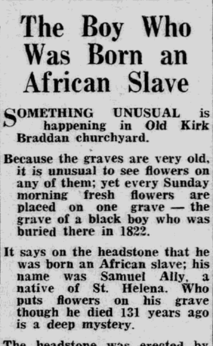
A hundred and thirty-one years after he died, the Examiner reported something unusual in the churchyard: fresh flowers on his grave every Sunday morning, and nobody could say who put them there. In 2012 one of Wilks’s successors as Speaker went to the churchyard and cleared the weeds from the grave himself.
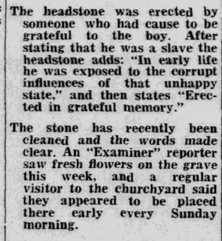
Another plaque marks the preaching stone, a mossy block cut with the words: Here William Drury, forty years Vicar of Braddan, preached the word of God. Drury was a Manx speaker who often preached in the language. He was vicar from 1847 until his death in 1887, and the open-air services at Braddan were his doing, begun in 1856.
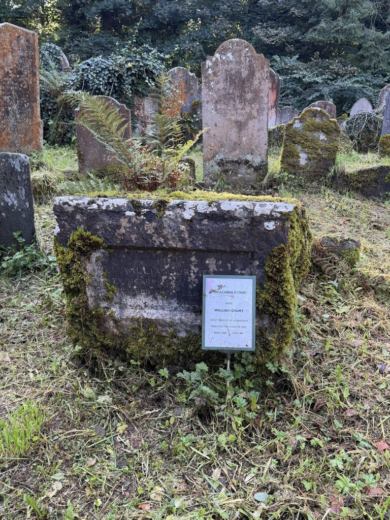
One name has no plaque, only a chain across it. Arthur William Moore, CVO, Speaker of the House of Keys, eldest son of William Fine Moore of Cronkbourne, born 1853, died 1909. He became Speaker in 1898, but he is better known for what he wrote: a History of the Isle of Man in 1900, and before it books on Manx surnames, place names and ballads. He founded the Manx Language Society in 1899 and was its first president. His Manx Worthies, published in 1901, has an entry for William Drury.
We had gone for stamps and a bench mark. How have I never been before?
The camp
The map had one more thing on it. Behind where the new church is now it has the word Camp, in the Gothic lettering the Survey keeps for antiquities, and around it, three times over, Inscribed Stones. We had never heard about them before.
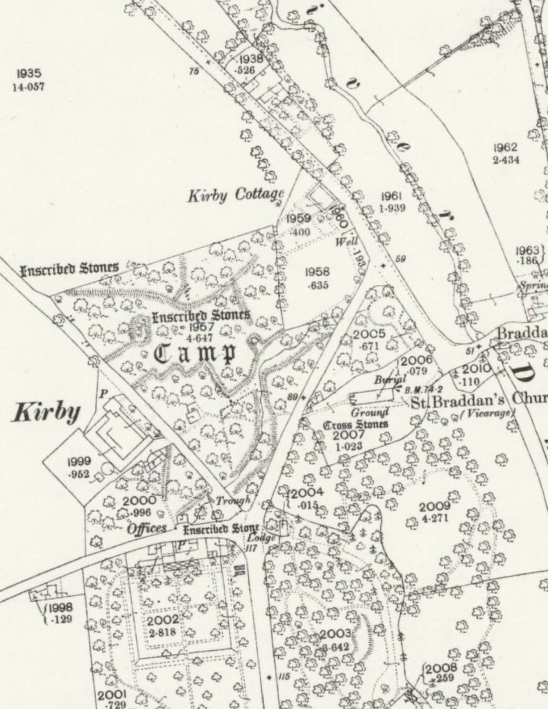
We pottered up, and were disappointed. The area is gated off, private land. But it was instantly recognisable that there are large boulders in there, laid out in rows and columns, clearly for some ancient ceremonial purpose. I watch a lot of Time Team.
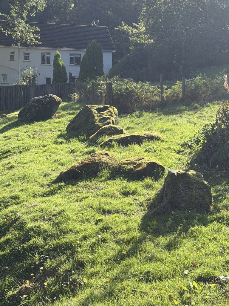
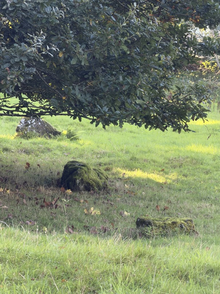
The antiquarians were just as sure, and did not agree with each other. Dr Oswald described a wall about seventy yards long opposite the churchyard, with stones four to six feet high set on end, close together, to form a parapet. Sir James Simpson, the Edinburgh doctor better known for chloroform, saw an ancient city or town with strong double walls, and on one massive stone at the edge of the wood he counted between twenty and thirty cups cut into the surface, some in rows and others in a ring round a central cup. The paper that quotes him was written by A. W. Moore, whose name we had just read on the tomb with the chain.
In 1910 the Antiquarian Society walked the ground and traced avenues running parallel with the Peel road, ending in a circle about 75 feet across, with rows of large stones set in lines at different angles. The 1930 list of Manx antiquities files the whole thing as Ballafletcher Camp, about a hundred yards west of the old church, under the plain heading of stone alignments. A stone built into a roadside wall near Kirby, known as the Saddle Stone or the Fairies’ Saddle, is said to have come from it.
Dr Oliver recorded one more thing: a large block of stone, 4 feet by 7 and a half, hollowed at the top like a font. One of the boulders in my photograph has a hollow in its top. I make no claim that it is the same one.
Then there is Archibald Knox, which I had not expected. In the Antiquarian Society’s archaeological report for 1918 to 1919, Canon Quine announced a class of inscribed stones “never heretofore observed or known to exist on the Island”: more than 150 of them, a longer list than all the ogam stones and ancient crosses put together, and by his reckoning at least a thousand years older than the runic crosses. He had enlisted Mr A. Knox, who found about a third of them. It was Knox who visited the camp in Kirk Braddan Wood after the timber was felled during the war. He found that the falling trees had thrown some of the stones of the earthworks out of place, and that several of them were inscribed with the same scheme of script and diagram as the finds elsewhere. His working hypothesis was that the script had come from the south of Europe by way of Spain, with Phoenician or Carthaginian traders prospecting for metals.
The funny thing is that my map was surveyed in 1866. Half a century before anybody announced a discovery, the surveyors had already written Inscribed Stones across the site three times. Quine allows for that, though only in the singular: the inscribed stone on the ordnance map, he says, is the so-called Sacrificial Stone. I am rather pleased that we found them for ourselves, with nothing more than a map over 150 years old.
One boulder, at the edge of what is now the car park, seems to form part of the inscribed stones. It has long grooves cut down one face, and the chisel marks are amazing.
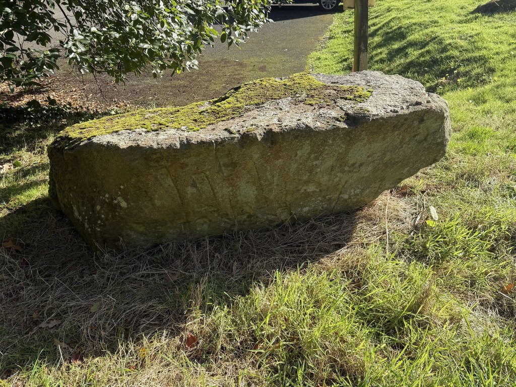
Fascinating, and a real shame that you cannot get up and see them, and that the place is not more of an ancient attraction. I suppose we have a lot of this stuff on the Isle of Man.
Peel
Then we went to Peel and checked the old ruined church there, St Peter’s.
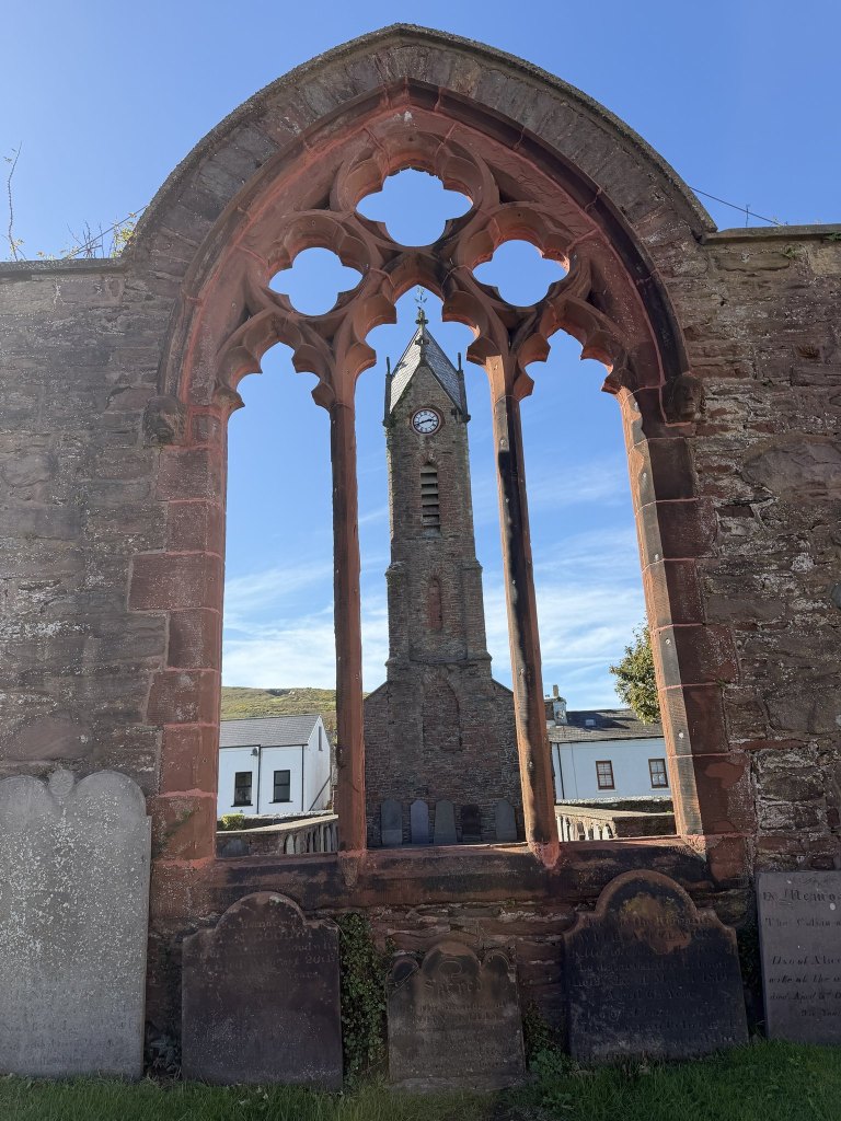
It is the Braddan story with a different ending. According to the Town Commissioners’ board, St Peter’s was the parish church of Kirk German for some three hundred years, until 1884, when the present cathedral succeeded it. It carried on as a Sunday school, with occasional services in Manx until 1939, and in 1958 it was demolished as unsafe. What is left is one end of the building with its window, the clock tower of 1872, whose clock was the gift of J. K. Ward, a Peel man who had prospered in Canada, and the churchyard.
How old the church was, nobody quite knows. The heritage walk leaflet says 1551. An account written in 1924 says there is no date on record, and quotes Canon Quine, he of the inscribed stones, who thought the fourteenth century most probable.
There is a bench mark noted on the old map here too. Its position is slightly unclear, but it looked like the corner of the church, or the kerb in front. We could not find it after an extensive search, and sadly it has been lost to time. Braddan’s mark survived because the building was left alone. If this one was on the church, it went with the church.
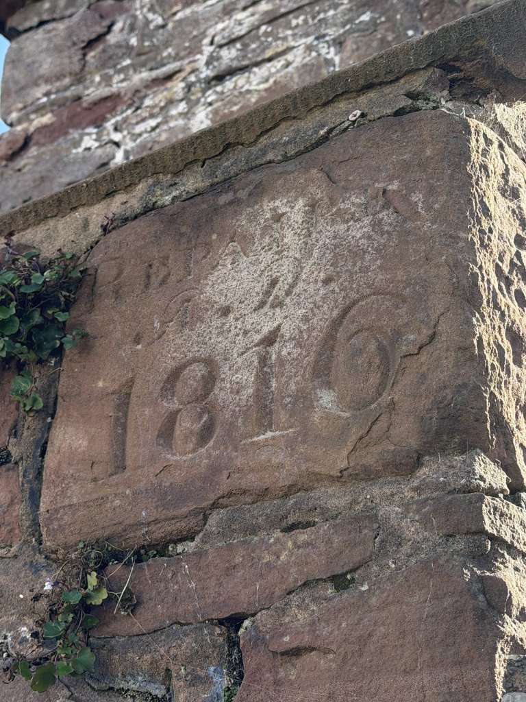
Lots of other cool stuff, though. One block of sandstone carries a date in big numerals, 1816, under a line of lettering that the weather has mostly taken. The Commissioners’ board says the church was rebuilt in the early nineteenth century, and the 1924 account mentions a tablet for a rebuilding in 1826, so this stone is ten years ahead of the tablet.
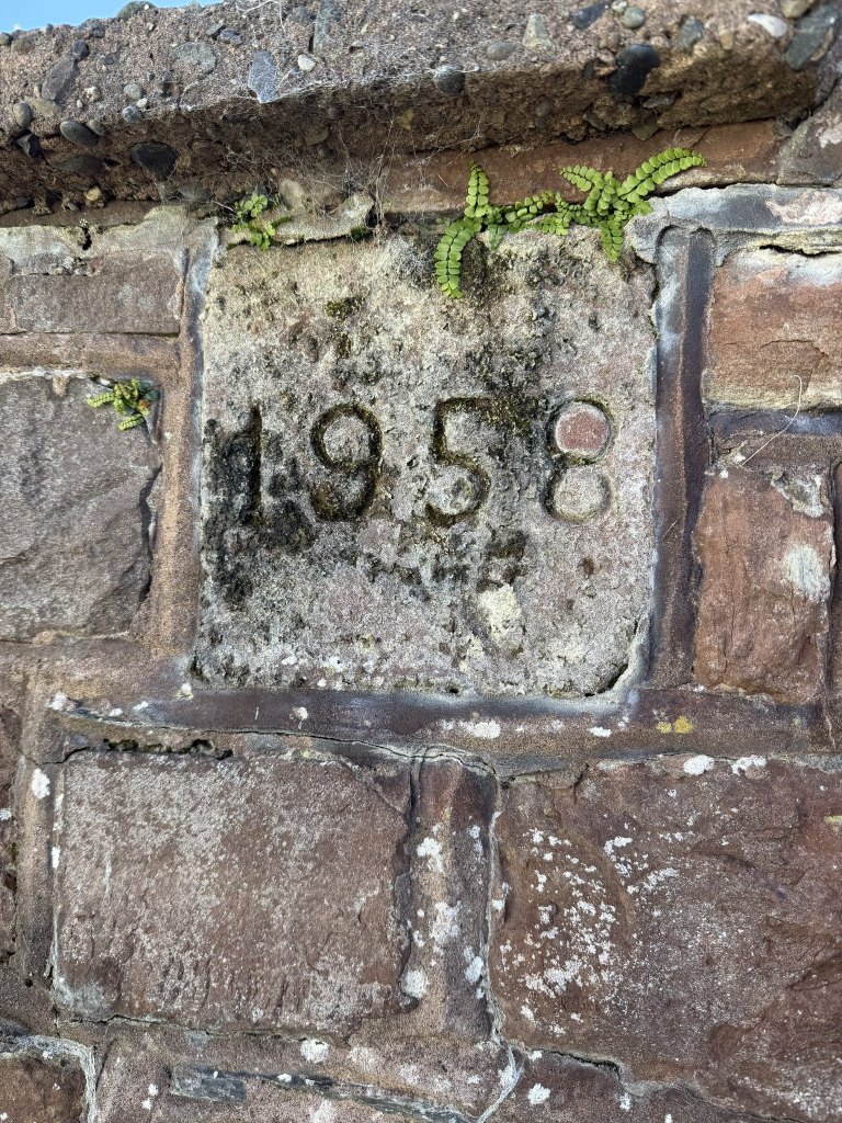
Another stone, small and square and a good deal newer, says 1958: the year the church was destroyed.
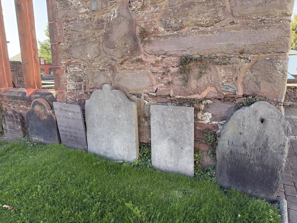
The gravestones have been stood up along the walls. John Graves, who dy’d in March 1775, leans against the ruin itself.
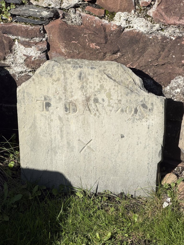
T. Dawson gets a name, a cross and nothing more, and whoever cut the name put the S in backwards.
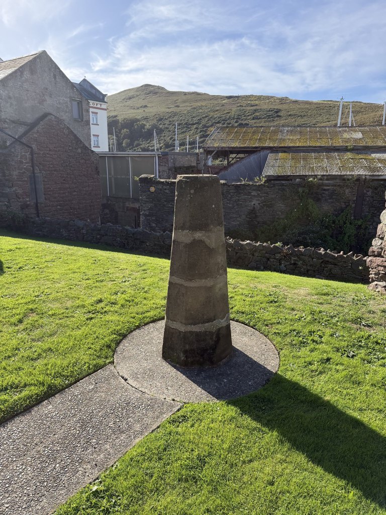
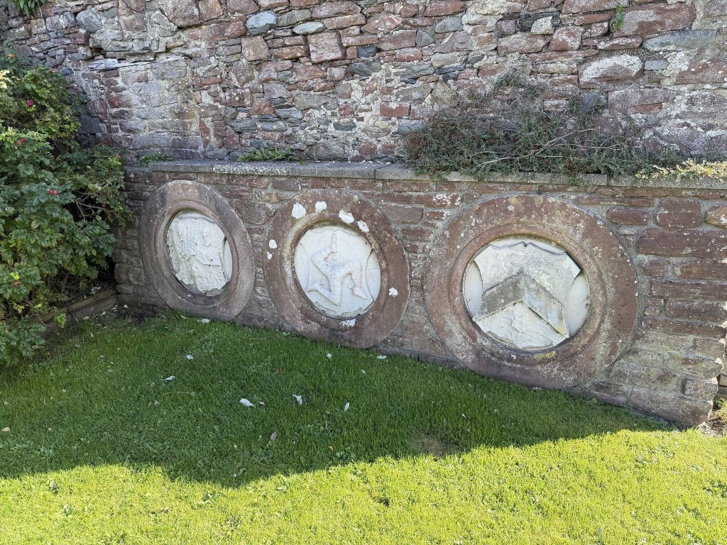
From there we went on to the Castle Street Play Area, which has a small obelisk of its own and, against one wall, three carved roundels. The middle one is the three legs. The one on the right is a shield with a chevron, and the one on the left has weathered past reading.
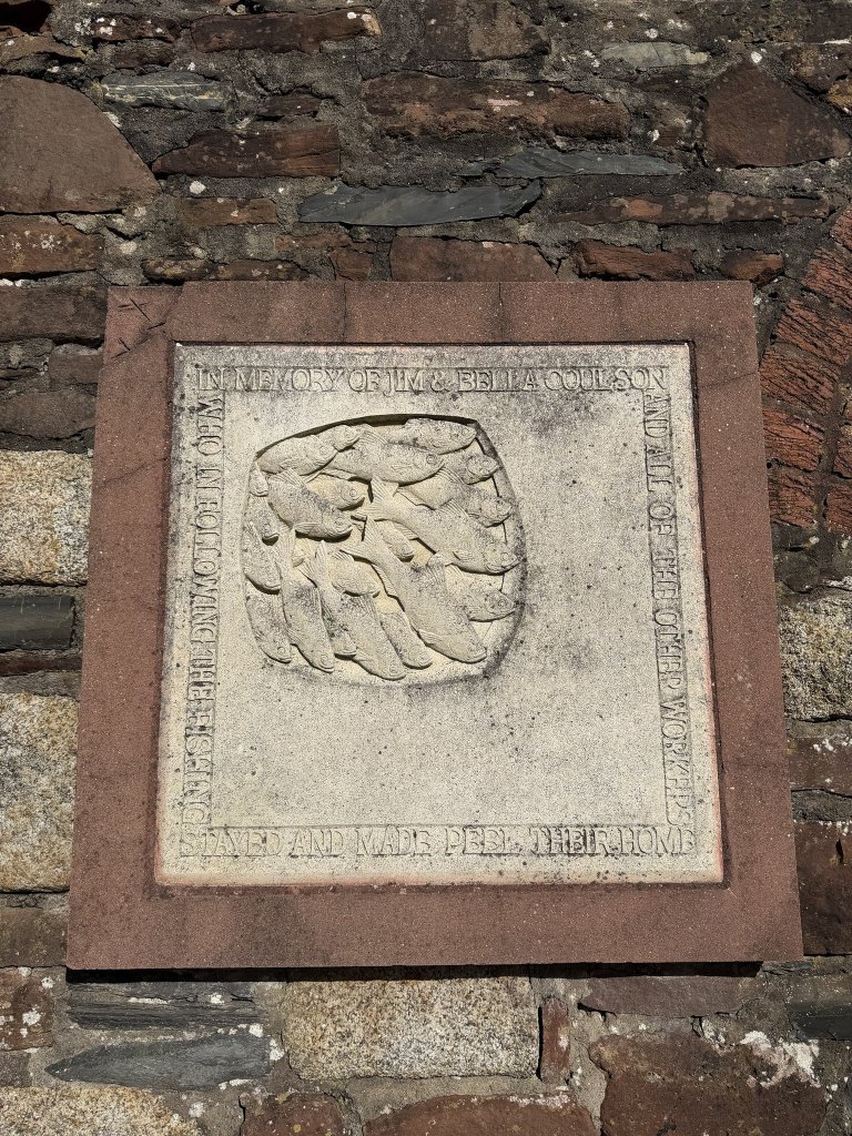
On another wall is a shoal of herring carved in stone, in memory of Jim and Bella Coulson and all of the other workers who, in following the fishing, stayed and made Peel their home.
The sign
We also went to my favourite antique shop, the Old Bonded Warehouse on Castle Street, where I noticed a ghost sign in the entrance. I have been to that shop loads and have never noticed it. It is a patch of old lettering left bare in the paintwork: licensed to sell wine, spirits, ale and tobacco. The line above is a name, worn but readable with a little faith: Patrick Fisher. It even looks as though there is another sign beneath it. In the top left corner there was a word starting Cath, which would cut across Patrick.
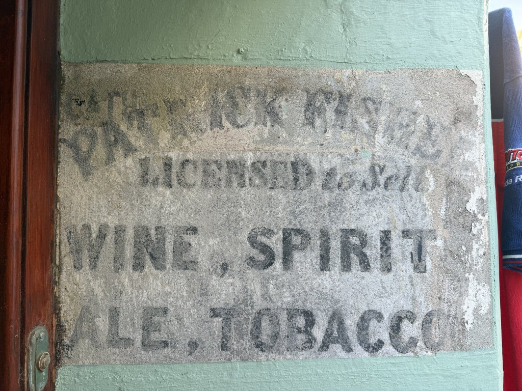
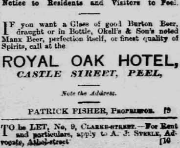
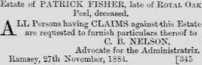
He turns out to be findable. The 1881 census has Patrick Fisher, aged 37 and born in Ireland, keeping the Royal Oak on Castle Street with his wife Catharine, who was from Ramsey, and who may well be the Cath in the corner. His own newspaper advertisement offers a glass of good Burton beer, Okell’s noted Manx beer or the finest quality of spirits at the Royal Oak Hotel, Castle Street, Peel, and adds Note the Address. By November 1884 he was dead: a notice that month calls for claims against the estate of Patrick Fisher, late of Royal Oak, Peel. George Goodwin, who wrote down his memories of old Peel, names Pat Fisher as the last landlord. After him the house stopped being an inn, was sold to Samuel Dale, and ended up as the Dale Home, an alms-house for the old people of the town. By 1907 the house was numbered 29 Castle Street, which is the address of the Old Bonded Warehouse today, so the sign in the entrance appears to be Fisher’s own. The Ward Library opposite opened that same year, another gift of J. K. Ward, who gave St Peter’s its clock.
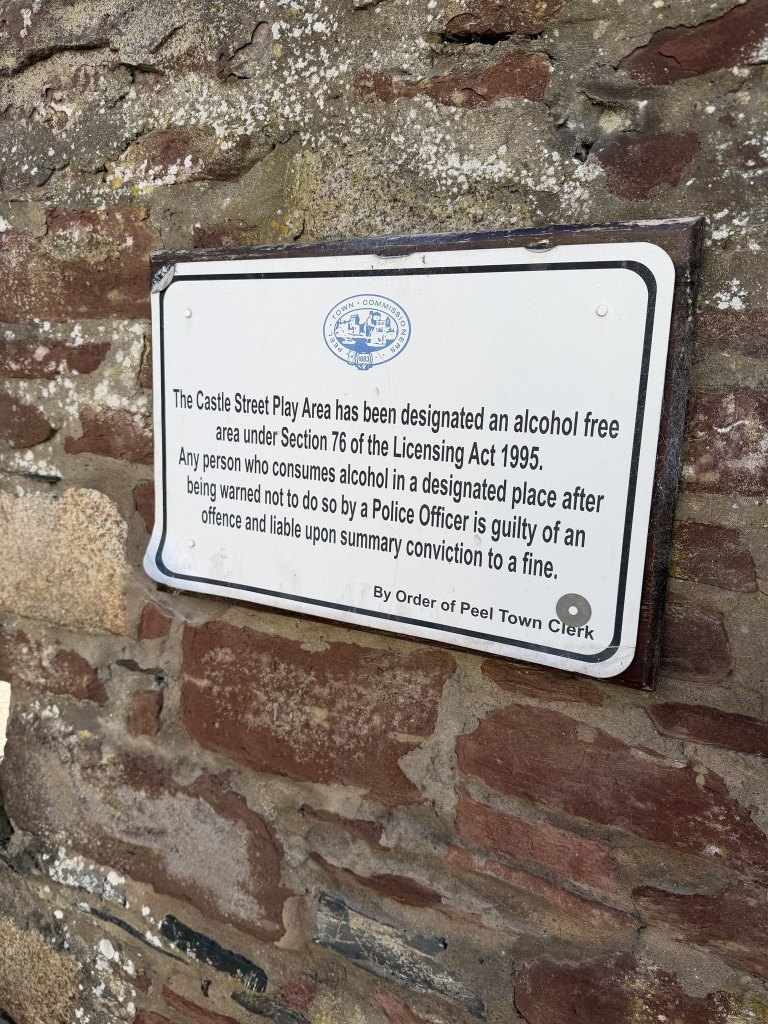
Castle Street has evidently held both positions on drink, because the play area with the roundels carries a notice from the Town Commissioners declaring it an alcohol free area under Section 76 of the Licensing Act 1995.
The warehouse
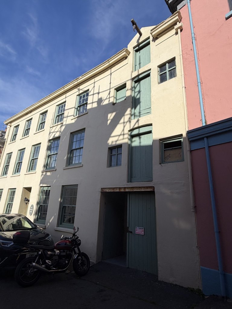
On the same street is a very cool old industrial building, with a pulley and doors above ground, clearly to hoist in goods: perhaps a warehouse for goods brought into the harbour. The doors are stacked one above another, a floor apart, and the beam still sticks out over the top one. I’m sure I’ve noticed it before, but I don’t remember noticing it before.
Derek
After all that we had a quick sit on the Black Swan, where we were joined by one of the resident swans, now named Derek.
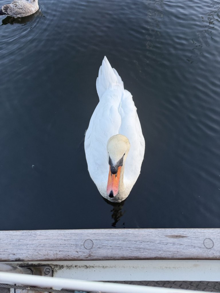
That was the day, really: a church, a field of boulders, a sign in a doorway and a warehouse, all of them next door to somewhere I already go. And then the neighbour came round.

